Introduction
This report provides a direct comparison of how the Cowichan Valley Regional District (CVRD) has changed its Development Permit Area (DPA) framework from Bylaw 4485 (2023) to Bylaw 4632, which received 1st through 3rd reading in February 2025. It focuses on what has materially changed, what has not, and where the regulatory burden has shifted.
Temporary Use Permit (TUP) provisions included in Bylaw 4632 are not reviewed in this report.
While the number of DPAs has been reduced through consolidation, the practical effect of Bylaw 4632 is not simplification. Exemptions have been narrowed, definitions expanded, and application requirements increased. The most substantive changes are found in Development Permit Area 1 (Riparian Protection) and Development Permit Area 9 (Form and Character), which together represent the primary shift in how the bylaw applies to private land.
It is also important context that 2023’s Bylaw 4485 was structured to carry forward. Section 3 confirms that its development permit exemptions and guidelines apply not only to the 2021 Official Community Plan, but to any successor bylaw adopting an official community plan. As written, the framework was intended to remain in effect as the broader planning context evolved, without requiring a full replacement to continue processing applications.
This context matters in understanding the transition. The move to Bylaw 4632 is being framed as a necessary update aligned with the MOCP. At the same time, the existing bylaw already provides a continuous regulatory framework, raising practical questions about how and when new standards should apply, particularly for applications already in process.
Structure of Change Across DPAs
The transition from the current Bylaw 4485 to 4632, tagged as an MOCP-required update and described by the CVRD as minor, reduces the number of Development Permit Areas from thirteen to ten through consolidation, primarily within Form and Character. It has been framed as a positive update that provides clarity, streamlines the process, allows applications to move forward more efficiently, and reduces the number of Development Permit Area requirements compared to the previous framework.
While presented as an alignment exercise, the changes extend beyond structural consolidation.
Across the DPAs, three consistent patterns emerge. The scope of regulation has expanded through broader definitions and new triggers. Long-standing exemptions have been reduced or removed, increasing the number of activities requiring a permit. At the same time, new reporting requirements and enforcement mechanisms have been introduced, adding complexity to the application process. In several areas, the bylaw also applies standards that go beyond baseline provincial frameworks, extending local regulatory influence over how land is used and developed.
What follows is a direct comparison of each Development Permit Area.
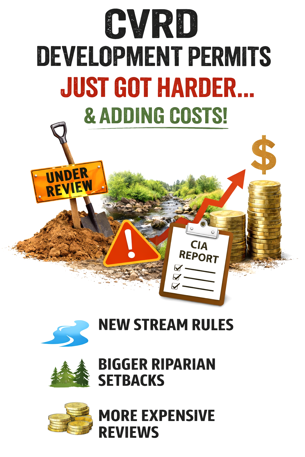
CIA Reports – How Your Property’s History Could Impact Your Future
Under current DPA bylaws applications were forward-looking and required a Qualified Environmental Professional (QEP) to assess only proposed development.
Under Bylaw 4632, applications now capture both proposed development and, where applicable, existing site conditions resulting from unauthorized works. This introduces a broader scope of review at the application stage.
Under Bylaw 4485, there was no formal mechanism within the development permit process to address unauthorized works. Applications were limited to proposed development and focused on avoiding or minimizing impacts.
Bylaw 4632 introduces the Condition and Impact Assessment (CIA) as a defined requirement where unauthorized works have occurred. In these cases, the applicant must retain a Qualified Environmental Professional to prepare a report as part of the development permit application.
The CIA report requires more than an assessment of current conditions. It includes reconstruction of pre-disturbance conditions, identification of unauthorized works, and evaluation of impacts to riparian function. Based on this, the report must set out specific remediation measures.
These measures may include removal of structures, regrading, soil management, and re-establishment of vegetation. Where watercourses or wetlands have been altered or buried, they must be restored, including daylighting where applicable.
The CIA process introduces a retrospective component to the development permit system. Approval of new or continued use of the land becomes tied to addressing past works.
The bylaw does not establish a defined look-back period and does not address how changes in ownership are treated. The requirement is tied to the condition of the land at the time of application. And this is not a requirement by the province.
Development Permit Area 1: Riparian Protection
DPA 1: Riparian Protection
Bylaw 4485 vs. Bylaw 4632
Under Bylaw 4485, riparian regulation was tied closely to fish habitat and focused on assessing proposed development. Under Bylaw 4632, both the trigger for regulation and the response to non-compliance have been expanded.
1. The “Ditch” Recategorization and Increased Riparian Setbacks (DPA 1)
- Under 4485: Ditches were only legally considered streams if they provided “fish habitat”. If your property had standard roadside or boundary ditches without fish, they were largely ignored during subdivision. Furthermore, lot line adjustments were explicitly exempt from needing a permit.
- Under 4632: A ditch is now legally a stream if it is “connected by surface flow” to another waterbody, regardless of whether it contains fish or even usually contains water.
- The Impact: If your subdivision parcel has a connected ditch, you must legally allocate the entire 30-metre Riparian Assessment Area to remain completely free of buildings, structures, and land alterations. Over and above that, you must design the subdivision so that every single new parcel has a suitable building envelope and driveway set back an additional 7.5 metres from that 30-metre area. This forces an effective 37.5-metre “no-build” buffer along every ditch, drastically reducing the buildable land on your new lots. Additionally, the exemption for lot line adjustments in riparian areas has been removed entirely.
Lot Line Adjustments
Under Bylaw 4485, lot line adjustments within riparian areas were explicitly exempt where no additional dwelling opportunity was created.
Under Bylaw 4632, that exemption has been removed. Lot line adjustments within Development Permit Area 1 now require a development permit.
Subdivision Design
Under Bylaw 4485, subdivision design was not subject to additional riparian separation beyond standard assessment requirements.
Under Bylaw 4632, subdivision design must locate building envelopes and access outside the riparian assessment area. In practice, this results in additional separation beyond the 30 metre assessment area, often functioning as an effective 37.5 metre setback for new developments.
Impact on Development and Housing Costs Bylaw 4632 – Our MOCP at Work
Impacts on Permits and Development
There are a few key changes in this bylaw that directly affect how — and whether — projects move forward.
Under DPA 9 (Form and Character), the process now starts much earlier. Before an application can be submitted, developers are required to complete professional reports upfront. This includes shadow impact studies in certain areas, showing where a building’s shadow will fall at specific times of day, as well as written summaries addressing greenhouse gas reduction, energy, and water use. These must be prepared by registered professionals and submitted with the application. In practical terms, that means added time and cost before an application is even filed.
Under DPA 1 (Riparian Protection), the changes are more restrictive. The definition of a stream has been expanded to include ditches connected by surface flow, whether they contain water or not. For subdivisions, this means setting aside the standard 30 metre riparian area and designing each lot so buildings and access are pushed further back. The result is less usable land, particularly along property edges where these features exist.
There is also a new requirement called a Condition and Impact Assessment (CIA). If work was done in the past without a permit in a riparian area, it must now be addressed as part of a new application. This requires a Qualified Environmental Professional to assess the site, identify impacts, and outline remediation. Depending on the situation, this can include removing structures or restoring altered watercourses.
The bylaw does not set out specific timelines or costs, but these changes add both. More upfront work, more professional involvement, and a more complex process at the beginning of a project. That affects how long approvals take and increases the cost of development, which ultimately flows through to housing.
This is not just a technical update. It changes how development is planned, approved, and delivered on the ground.
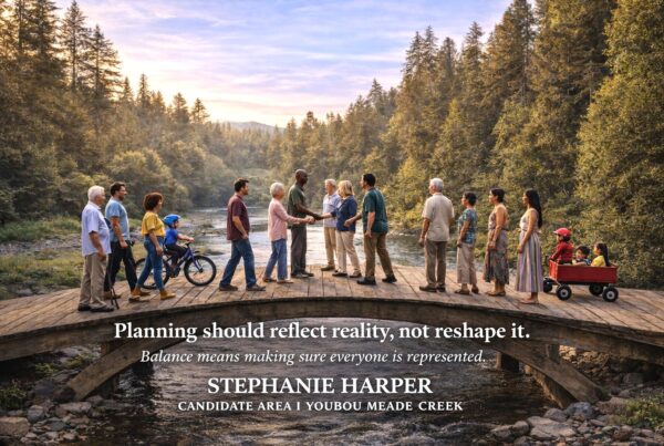
My Position as AREA I Candidate
We need to be honest about what this does.
We need to make it easier to build, not harder. Less bureaucracy, not more. And a system that is more affordable for everyone involved — from property owners to builders to taxpayers.
Right now, we’re moving in the opposite direction.
This bylaw adds layers of complexity at the front end of every project. More reports, more process, more uncertainty. That means higher costs, longer timelines, and more pressure on housing affordability. It also means more staff and more administration to manage it — costs that ultimately fall on taxpayers.
In several key areas, the bylaw goes beyond provincial requirements. It expands the definition of streams to include ditches that may not contain water or fish habitat. It pushes setbacks beyond provincial standards in subdivision design. It introduces Condition and Impact Assessment (CIA) reports as a new layer of local enforcement for past works. And it mandates outcomes, like daylighting buried streams, that are typically handled at the provincial level.
This approach increases regulation without clearly improving outcomes.
We need a system that is practical, predictable, and aligned with how development actually happens. Protect what matters — our environment, our agriculture, our communities — but do it in a way that people can work with, not fight through.
I believe in common sense planning. Clear rules. Fair expectations. Alignment with provincial frameworks where appropriate. And a focus on getting projects moving, not slowing them down.
Because right now, this isn’t it.
Note on Content
I have a strong background in planning, development and bylaws, but I also recognize that not everyone works in this space day to day. These are complex, technical documents.
To help break them down, I’ve used AI tools to assist in organizing the information and generating explainer videos so people can better understand what’s changing and why it matters.
That said, I encourage you to take the time to read the actual bylaws yourself — both Bylaw 4485 and Bylaw 4632 — and make your own determinations.